


Garmin Zumo XT2 Motorcycle Sat Navigator


Garmin Zumo XT2 Motorcycle Sat Navigator
(Garmin 010-02781-20)
We Think You Should Know
- Australian Garmin Warranty
- Purchase Guarantee (see T&C's)
- 6" Screen Display
- Visual Route Planner
- Garmin Adventurous Routing
- Track Recorder
- Rider Alerts for Hazards
Overview
The Garmin zūmo XT2 motorcycle navigator is an excellent investment for motorcycle riders who are looking for a high-performance device to enhance their riding experience. Its bright 6″ display is glove-friendly and packed with features to help you find the perfect motorcycle route. It is designed to withstand all types of weather conditions, vibrations, and rough terrain, making it a durable and reliable companion on the road. With the zūmo XT2, riders can easily customize their routes, track their friends, and enjoy popular moto paths.
Features
ULTRABRIGHT DISPLAY
The 6″ display is 15% larger than previous models and features an even brighter HD resolution in landscape or portrait mode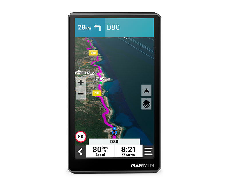
DESIGNED TO ENDURE
Rain? Vibration? Dust? Doesn't matter. This device is built to withstand all kinds of weather (IPX7) and rough terrain.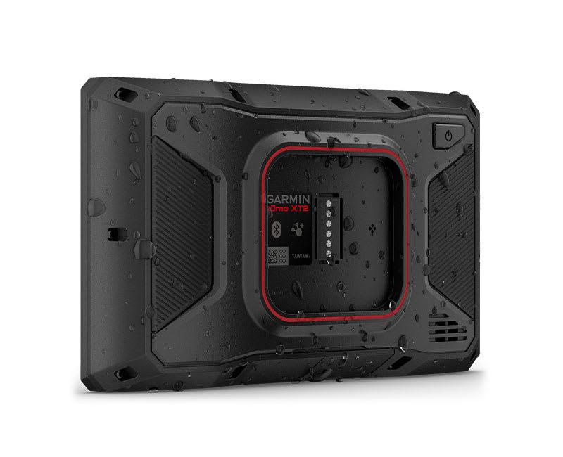
VISUAL ROUTE PLANNER
Plan a custom route on the device, or use the app with a compatible smartphone.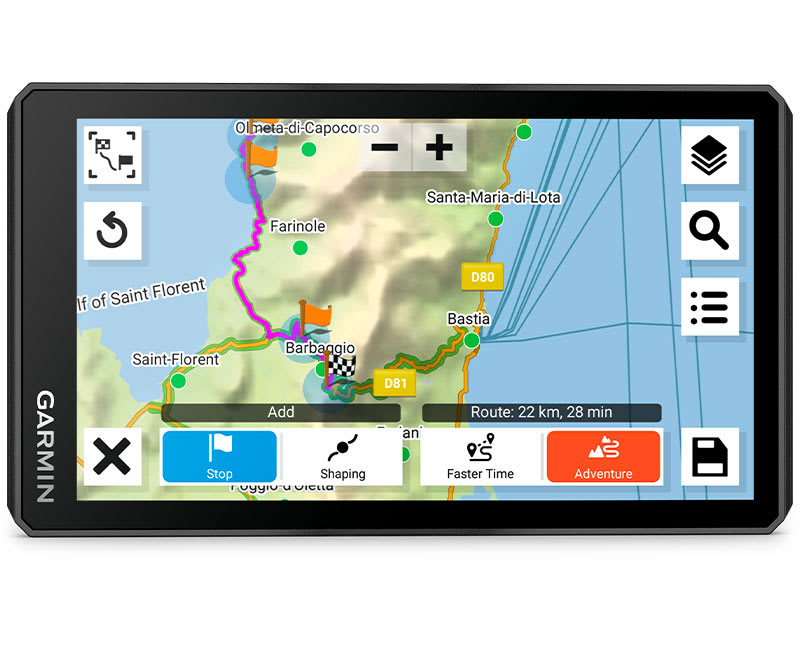
Group Tracking
Use the Tread® app on your smartphone and/or zūmo XT2 device to track friends with the Group Ride Mobile feature1. Or, use the Group Ride Tracker accessory2 (sold separately) for tracking other -equipped riders with no cellular coverage needed.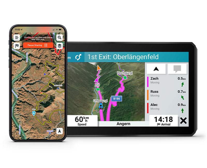
SIMPLE MAP SWITCHING
Quickly toggle between on-road maps, topographic maps and BirdsEye Direct satellite imagery, so you can always have the perfect map for your ride.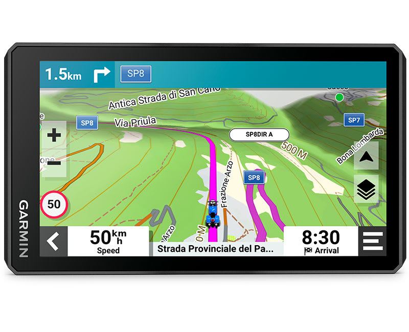
BIRDSEYE DIRECT SATELLITE IMAGERY
Use satellite imagery from around the world to help you navigate. Download the maps directly to your device via Wi-Fi® technology3. No annual subscription required.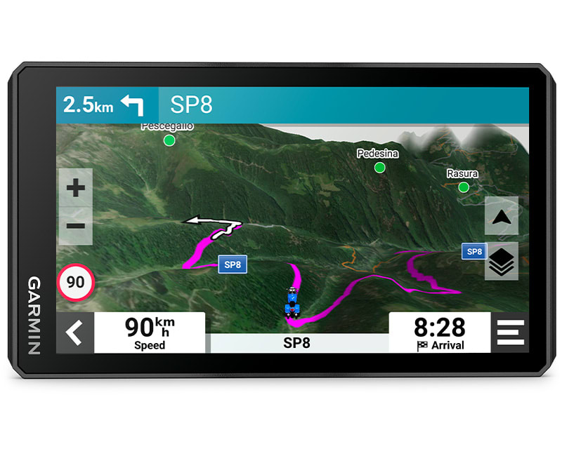
GARMIN ADVENTUROUS ROUTING
Straight roads are boring. Find the most thrilling routes with hills, curves and sights, and choose from 4 levels of difficulty.
GREAT RIDES
Find new routes on the Tread smartphone app. Bookmark them to automatically sync to your , and add difficulty ratings and upload photos to share with other riders.
POPULAR PATHS
See popular moto paths ridden by other riders to find new and exciting routes to explore.
RIDE SUMMARIES
Use the Tread® app to review your ride details, including speed, acceleration, decelerations, elevation and more.
TRACK RECORDER
Record your ride data such speed, distance, acceleration and more and share the details with friends on Tread® app.
SHARE YOUR FAVOURITE ROUTES
Easily send GPX files from your phone or third-party sources to your sat nav. Share GPX files with fellow riders by using the Tread® app.
MANAGE YOUR DATA
Easily manage4 tracks and routes across your sat nav and compatible smartphone by using the Tread® app.
TRENDY PLACES FEATURE
Discover the best spots along your route with suggestions for trendy places.
LOCAL SPOTS
Find local places to visit and exciting activities to try near your current location with local spot recommendations.
RIDER ALERTS
Get alerts for hazards along your route, such as upcoming sharp curves, speed changes and more.
MUSIC
Stream music from your smartphone through the sat nav, or play MP3 files stored on the sat nav — all to your connected helmet or headset.
WIRELESS UPDATES
Built-in Wi-Fi3 connectivity makes it easy to keep your maps and software up to date without using a computer. On-screen cues show when new updates are available.
EXTENSIVE MAP COVERAGE
Preloaded topographic maps with 3D terrain and street maps for Europe and Middle East. Africa including Tracks4Africa, North and South America, Australia and New Zealand maps are available as free downloads.
LIVE TRAFFIC AND WEATHER
Access real-time traffic and weather, share routes with other riders, and get phone notifications via the Tread® app4.
INCIDENT NOTIFICATIONS
If an incident occurs, a text message with location information is automatically sent to your predetermined contact4.
BLUETOOTH® CONNECTIVITY
Hear turn-by-turn directions or hands-free calling from your compatible smartphone through a connected helmet or headset.
INREACH® COMPATIBILITY
Pair with a compatible inReach satellite communicator5 (sold separately) for two-way messaging, location sharing and, in case of emergencies, SOS capabilities.
CONTROL YOUR ACCESSORIES
Pair the motorcycle sat nav with the compatible Garmin PowerSwitch™ digital switch box (sold separately) to enable on-screen control of your motorcycle's 12-volt electronics.
1 Tracking via Group Ride Mobile requires the Tread app running on your and each friend’s compatible smartphone with Bluetooth® technology and an active cellular connection
2 Group tracking with the Group Ride Tracker accessory is only available for riders using a sat nav and app. Connection to vehicle power is required for group tracking functionality.
3 Requires an active connection with Wi-Fi connectivity
4 Requires zūmo to be paired with your smartphone with Bluetooth® and GPS technology and running the Tread® app
5 Inreach devices require a Satellite subscription. Some jurisdictions regulate or prohibit the use of satellite communication devices. It is your responsibility to know and follow all applicable laws in the jurisdictions where the device is intended to be used.
© HERE. All rights reserved. Satellite imagery © 2023 Maxar Technologies (date of satellite imagery may vary). Wi-Fi is a registered trademark of the Wi-Fi Alliance. The Bluetooth word mark and logos are registered trademarks owned by Bluetooth SIG, Inc. and any use of such marks by Garmin is under licence.
Garmin - The Brand
Garmin is a leading worldwide provider of navigation, aviation, marine and outdoor and fitness products. Garmin products are known for the innovative features, compelling design and quality that is second to none. Here we stock the latest range of these fantastic products and believe they are of the best in their field, making us one of Australia's leading independent Garmin retailers.
General |
|
| PHYSICAL DIMENSIONS | WxHxD: 15.6 x 8.9 x 2.5 cm |
|---|---|
| DISPLAY SIZE | 13.3 x 7.5 cm (W x H); 15.3 cm diag (6”) |
| DISPLAY RESOLUTION | 1280 x 720 pixels |
| DISPLAY TYPE | Multi-touch, glass, high brightness HD colour TFT with white backlight |
| DUAL-ORIENTATION DISPLAY | YES |
| WEIGHT | 340 g |
| BATTERY | Rechargeable lithium-ion |
| BATTERY LIFE | Up to 6 hours (up to 3.5 hours at 100% backlight) |
| WATER RATING | IPX7 |
| DROP RATING | MIL-STD-810 |
| HANDLEBAR MOUNT (UP TO 1") | YES |
Maps & Memory |
|
| PRELOADED STREET MAPS | YES |
| DATA CARDS | microSD™ card (not included) |
| 3D TERRAIN | YES |
| INTERNAL STORAGE | 8 GB |
| ABILITY TO ADD MAPS | YES |
| EXTERNAL MEMORY STORAGE | Yes (256 GB max microSD™ card) |
| INCLUDES MAP UPDATES | YES |
| DOWNLOADABLE SATELLITE IMAGERY | YES |
Sensors |
|
| GPS | YES |
| GLONASS | YES |
| GALILEO | YES |
| 10 HZ MULTI-GNSS POSITIONING | YES |
Outdoor Recreation |
|
| POINT-TO-POINT NAVIGATION | YES |
| PRELOADED TOPOGRAPHICAL MAPS | YES |
| NAVIGATE-A-TRACK NAVIGATION | YES |
Navigation Features |
|
| VISUAL ROUTE PLANNER | YES |
| GARMIN REAL DIRECTIONS™ LANDMARK GUIDANCE | YES |
| TRIPADVISOR® TRAVELER RATINGS | YES |
| ROUTE SHAPING THROUGH PREFERRED CITIES/STREETS | YES |
| INCLUDES TRAFFIC | Yes (with Garmin Tread app) |
| LANE ASSIST WITH JUNCTION VIEW (DISPLAYS JUNCTION SIGNS) | YES |
| BLUETOOTH® CALLING | Yes (works with Bluetooth®-compatible helmet, headset or smartphone; BLE capable) |
| SPEED LIMIT INDICATOR (DISPLAYS SPEED LIMIT FOR MOST MAJOR ROADS IN AUSTRALIA AND NEW ZEALAND) | YES |
| DRIVER ALERTS FOR SHARP CURVES, SCHOOL ZONES, RED LIGHT AND SPEED CAMERA WARNINGS AND MORE | YES |
Advanced Features |
|
| SMART NOTIFICATIONS VIA APP | YES |
| WI-FI® MAP AND SOFTWARE UPDATES | YES |
| ACCESS TO LIVE SERVICES VIA APP | YES |
Motorcycle Features |
|
| CONTROL MUSIC AND MEDIA FROM SMARTPHONE OR MP3 PLAYER | YES |
| SUNLIGHT READABLE AND WEATHER RESISTANT | YES |
| GARMIN ADVENTUROUS ROUTING™ | YES |
| RIDER ALERT WARNINGS FOR SHARP CURVES, STATE HELMET LAWS, SPEED CAMERAS AND MORE | YES |
| PLANNED & DYNAMIC FUEL STOPS | YES |
| POPULAR PATHS (MOTO) | YES |
| ELEVATION PROFILE | YES |
| ROUND TRIP ROUTING | YES |
| SERVICE HISTORY LOG | YES |
| TRACK SUPPORT | YES |
| CUSTOM MAP SUPPORT | YES |
| TOPO MAP SUPPORT | YES |
| WIRELESS ANT+® TECHNOLOGY | YES |
Adventure Features |
|
| PAIR WITH COMPATIBLE INREACH® DEVICES | YES |
| PAIR WITH GARMIN POWERSWITCH™ DIGITAL SWITCH BOX | YES |
| COMPATIBLE WITH GROUP RIDE TRACKER (6”, 8” AND 10”) | YES |
| GROUP RIDE MOBILE | YES |
| TRACK RECORDER (BREADCRUMBS) | YES |
| COMPATIBLE WITH THE GARMIN TREAD APP FOR ROUTE PLANNING AND DATA MANAGEMENT (WAYPOINTS, TRACKS, AND ROUTES) | YES |
| GLOVE-FRIENDLY TOUCHSCREEN | YES |
- zūmo XT2
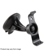
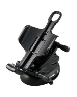
- Motorcycle mount and hardware
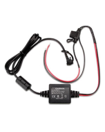
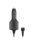
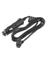
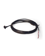
- Motorcycle power cable
- USB Cable
- Documentation
Peace of Mind Purchase Guarantee
This product is supplied via Garmin Australia and enjoys the FULL benefits of the 'Genuine Garmin Australian Warranty'. (You may also be entitled to other consumer warranties as provided by the Australian Consumer Guarantee and these entitlements are not limited by this warranty). In the event that this product should fail please contact our service department or you can speak with Garmin Australia directly.
We are a FULLY AUTHORISED Australian retailer for Garmin Australia.
Disclaimer
Due to differing operating costs associated with selling products via different marketplaces, our pricing may vary.
The information below is required for social login
Sign In
Create New Account